Home of Indian Jim Henry with drawings, by Clyde Lee Jenkins
The Rock House with pictures, by Peggy (Smith) Hake.
27 Sept. 2014, Dianna (Hale) Mattingly and Patricia (Bittle) Milholland visited the infamous Rock House of the resident Indian, Jim Henry. Pat had heard about this place for most of her life and I had only heard about it for the past several years. I drove around one day and looked and looked, but was not able to locate it.
However, while we were looking for an undocumented cemetery, we had the opportunity to finally visit the Rock House. It is amazing. Your mind wonders to back when – as you imagine their way of life and the hardships they endured. What an incredible day. We found our new cemetery – Winters Family Cemetery and visited the Rock House.
Home of Indian Jim Henry
by Clyde Lee Jenkins
Home of Indian Jim Henry
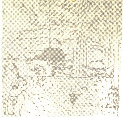
The best known Indian was Jim Henry, probably the last of the Osage tribe to have lived in Miller County. He was so well liked that a township, a church, a creek, and a school were named for him. He lived with his wife and children in a large rock house built by Mother Nature in Township 41N, Range 13W, Section 18.
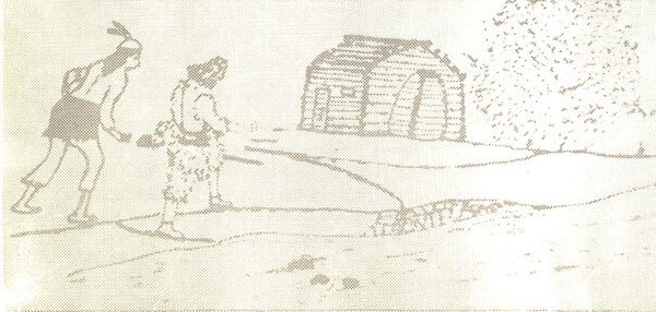
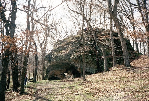
The rock house they lived in was, and still is, a natural oddity. It is a large, freak rock formation located on a wooded hill-top with no other formations around it. It is about sixty feet in length, circular in shape, and twenty or more feet in height. On the south side of the rock there is a large opening, with an opening somewhat smaller on the east side. Inside there is a spacious cavern. Through the rock is a natural built-in chimney. A fire inside the cavern would have smoke drawn through the cavern ceiling to the top of the rock. Cooking over an inside fire, with heat for warmth, in a smoke free room, left little to be desired in the means of a comfortable dwelling. With skins stretched over poles placed in the openings of the cavern, Jim Henry and his family enjoyed living in a primitive, but comfortable, Indian home.
In the Spring of 1834, Jim Henry, his squaw and two children were visited by Mr. William Miller and his young son, Pinkney S. It was noted by them that the Indian had chiseled the print of his hand on a large projecting rock as a mark of his prosperity. The hand print may still be visible.
What became of Jim Henry and his family is unknown. Some say he went to his people in the southwest. Others say he made a farewell speech at Tuscumbia where he thanked the people for the kindnesses always extended to him and his family, then departed for a destination unknown to anyone. There are Indian graves close by the old rock home located in the township of Jim Henry, but nothing is known about them. Today, the rock house sits quietly upon the secrets of an Indian family which once lived in its cavern.
The dress of an adult Indian, man or woman, was a waist-cloth and a belted blanket made from animal skins. No clothing was worn by Indian children until almost grown. Their first garment was a long, home-made shirt, - the first sack dress in Miller county. The Osages lived in crude shelters made of skin and bark.
Isaac Bilyeu and his wife, both under twenty years of age, having followed Bill Hews into the Gasconade country on a hunting expedition in late 1818, settled on the Big Tavern creek east of present day Iberia in the early 1820’s. For a number of years their closest neighbors were John Wilson on the Barren Fork, and Daniel Brumley on the Big Tavern.
Isaac hunted for deer and bear, of which there was an abundance. From these animals he got meat for food and skins for leather breeches. For a number of years he got corn from James Harrison, 1 then living at the mouth of the Little Piney in present day Phelps county. Isaac kept this corn inside his cabin, concealed in a hollow-log barrel. When needed for food a small portion of the grain was placed in a bowl-shaped rock and crushed with a round stone by hand.
Isaac Bilyeu settled on the Big Tavern creek in the early 1820’s.
For a number of years he hunted with an Indian Chief named Rodgers.
Until about 1829, Isaac hunted with an Indian Chief named Rodgers. Chief Rodgers, a White man, was removed from the cradle of his parents by Indians raiding White settlements near modern Pittsburgh, Pennsylvania, before the Revolutionary War.
After the War, Rodgers’ Shawnee band drifted down the river from the falls of the Ohio to the Mississippi, crossing the Father of Waters and hunting leisurely, northwestwardly into the Ozark mountains. Upon reaching the Gasconade country, finding game to be in such an abundance, they ceased moving, erecting their villages on the Gasconade and Big Maries rivers. The area of the Big Tavern creek was a portion of their hunting grounds.
The band by whom he was kidnapped eventually made Rodgers their Chief.
In the late Autumn of 1815, Daniel Brumley, having settled on the Big Tavern creek, obtained a supply of maize from the Indians at one of their villages on the Big Maries. At Cedar creek he visited Jim and Archie Snowgrass, two young men from Tennessee, fifteen and seventeen years of age.
In 1823 Brumley accompanied Campbell Crismon to the Missouri river for salt coming down in canoes from the Boon’s Lick. Campbell Crismon’s wife, a half-blood Cherokee, was called Wannah. Campbell told Daniel that his wife, when a young girl, witnessed the torture of a Creek Indian captured by her father, a White man living with the tribe, and other warriors, while on the warpath in the Great Smoky Mountains of South Carolina.
Watching her people burn the young Creek to death at the stake, she observed, although the fire seared his flesh, he stood like a statue, for no Indian ever displayed any emotions in times like this. Only his hands moved slowly, twisting and assuming grotesque shapes, as he suffered through the agonies of flaming death.
The vision of the ordeal remained in Wannah’s mind, becoming more intensified in the later years of her lifetime. Until her death, in moments of solitude, Wannah might be seen twisting, turning, and rubbing her hands.
In earlier days a corn dance was held by the Osage tribe on the Big Tavern creek each Spring, near their village north of the Wilson cave, celebrating the appearance of the first green springs of maize.
Hearing of very fertile land along the Osage river, in the late 1820’s, John M. Brockman settled six miles above later day Tuscumbia, by a big spring. He moved there with a yoke of oxen, an ox-cart, a gun, a double-bit axe, and a few hand tools from in the vicinity of a very small settlement called Pleasant Mount on the prairie.
He cleared with great toil an area out of the wilderness near the big spring. In a short time he was joined by a stranger from the other side of the river. The stranger carried information that if logs were to be raised for a cabin, Mr. Brockman could find a pattern already cut on the other side of the Osage. He had the logs for a cabin ready to be raised, but there were too many Indians. They had not molested him in any way, but friendly or not their standing and sitting around watching while he worked made him nervous. He was returning to civilization and giving his tenancy back to the Indians. He was returning to the vicinity of Pleasant Mount on the prairie.
John M. Brockman crossed the river and found the pattern. In a few days the logs were raised and the cabin completed. The Indians remained in the vicinity several weeks. Later, the land was patented by Mr. Brockman during the administration of President Andrew Jackson. This farm remained in the Brockman family until 1948, - more than 120 years. The Brockman farm, the Brockman Ford across the Osage river, the Brockman Ferry, the Brockman steamboat landing and the Big Spring, were early landmarks in Miller county.
The early settlers along the Dog creek in Miller County were informed by the Indians that once upon a time the backwaters of the Osage river filled the creek to the upper spring on the Zelly branch. In elm bark canoes they had traveled from the river to the spring. The settler believed this impossible since the spring was located too high in the valley and far from the river. In 1943, the waters of the Osage river flooded the Dog creek and the Zelly branch filled to the upper spring. The high waters referred to by the Indians probably occurred in 1785, noted as the Year of the Great Waters on the Mississippi.
In 1828, Samuel Gilleland and his wife, Mary, settled on a tract of land near present day Olean. The deer and the wolves played on the prairie where Eldon is located. A lone Indian, or a group of Indians in single file, traveling across the prairie were viewed as a part of the primitive scene.
An Indian trading post was at present day Tuscumbia. A village of Indians occupied the bank of the Osage river at the foot of the bluff and by the spring. A White man was told by an Indian that if ever a cabin was placed at this point it should be raised above a certain mark on the bluff side to be safe from floods.
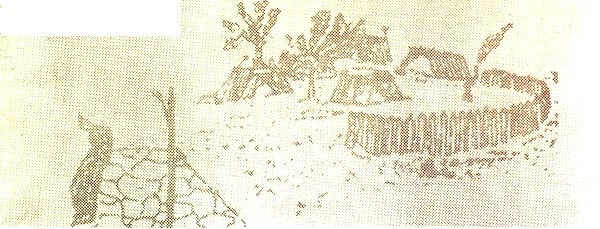
Village of Indians at Tuscumbia
In a treaty with the Osage Nation on November 10, 1808, at Fort Osage, located on the south bank of the Missouri river east of present day Kansas City, the Indians ceded their lands in Missouri to the Government of the United States. For these lands, and others, the Great Osages received $1800 in cash and merchandise, the Little Osages half that amount; a bargain of fantastic proportions.
However, upon ceding this part of their land to the Government they retained a right to hunt over the ground for a number of years. These hunting parties made the people nervous, and Indian scares were common, especially on the North side of the Osage river. Often families slept concealed near their cabins. At other times a number of families gathered in one place for protection against imminent attack, but always the Indians were peaceable.
After the Indians ceased hunting in Miller county, small groups occasionally passed through the territory following the old Harmony Mission Trace and Indian trails going to and from St. Louis or to visit the great White Father in Washington. The Old Harmony Mission Trace was the White man’s first overland trail through Miller county. It was used by the first settlers from the East coming to Central and Western Missouri, and earlier, by the fur traders and trappers of the tribe of Daniel Boone.
In Many parts of Miller county artificial mounds and other remains give evidence of Indian habitation. The Osages buried their dead by covering the corpse, wrapped in skins, with stones. Buried side by side and covered with stones, mounds of considerable size were erected.
The sole inhabitants of the forests and the prairies when the White man arrived on the scene, the Osage Indians, after 1835, were generally gone as long as the sun shall shine or the waters run in the rivers, forever.
1. The father of James Pryor Harrison, and John Benjamin Harrison who established a trading post at Tuscumbia.
ROCK HOUSE-OSAGE INDIANS
By Peggy Smith Hake
The Osage Indians, who dwelt in the land of Miller County long before it became a county, were the tallest race of men in North America. Few stood under 6 foot and some reached 7 foot in height. The most famous member of the Osage tribe to live within the boundaries of Miller County was Jim Henry. He and his family lived in a unique cave which has been called 'the rock house' over the generations. His legend lives on in our county because his name remains as a township, a creek, and a school.
Many years ago, before the white man arrived, Miller County was inhabited by the Osage Indian tribes. They lived mainly along the basin of the Big Tavern Creek, which was rich in vast forests and was plentiful with game and wildlife. It has been recorded that in 1822 an Indian village was located near the Barren Fork of the Big Tavern Creek. Evidently there were members of the Osage tribe who also settled north of the Osage River and lived close to the creeks and tributaries of the mighty Osage.
The Rock House
The Osage were the tallest tribe of Indians in North America, often reaching a height of 7 feet. Their proper name was Waszhazhe, but the French traders derived the name Osage from their original pronunciation and it has remained Osage for over 2 centuries. Perhaps the most famous of the Osage Indians in the Miller County area was a man named Jim Henry. I am assuming he had a tribal name of the Osage language, but was dubbed Jim Henry by his white friends who homesteaded in the new frontier of Missouri territory. He was probably the last of the Osage tribe to live in Miller County and he was so popular that his name remains today in our county's history; a township, creek, church, and a school were named for him.

The Rock House Inside
Jim Henry, his wife, and children lived in a remarkable, natural stone house built by Mother Nature. Today it still stands on a hillside, in Jim Henry Township, overlooking a beautiful green meadow and Highway 17 can be seen about one-half mile to the west. I visited this old stone cave a few years ago and was astounded at my first glimpse of this rock home, which is nothing more than an enormous, freak rock formation sitting atop the hillside. The residents of Jim Henry Township refer to it simply as "The Rock House". It is approximately 60 feet in length, is circular in shape and is approximately 25 feet high. With animal skins stretched over poles and used as walls to hold out the winter's cold, I could easily see how this Indian family lived comfortably in their 'rock house'.
What happened to Jim Henry and his family is unknown. They disappeared from Miller County sometime in the time era of the late 1830s or early 1840s and were never heard from again. In 1854, a man named Samuel Greenup patented the land on which the 'Rock House' was located and since that year, various families have owned the land including the families of Martin, Fowler, Winters, Tellman, Johnston, Albertson, and for the past few years has been the home of the Schulte family. As I left the hillside, where stands that unique, beautiful "House of Stone", my one thought was simply this," Oh, if only those ancient walls could talk!"